- by foxnews
- 08 Apr 2025
Sydney floods: residents brace for another day of devastating weather as NSW coast battered by rain
Sydney floods: residents brace for another day of devastating weather as NSW coast battered by rain
- by theguardian
- 04 Jul 2022
- in news

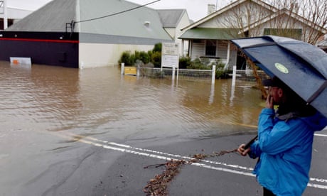
Thousands of people across the greater Sydney region were under evacuation orders on Sunday and more than 130 rescues took place as an east coast low, which is expected to persist until Tuesday, brought widespread rainfall, thunderstorms and flash flooding to parts of the state.
Authorities warned the impact could be more severe than the past three major weather events.
More than 40 evacuation orders and 44 evacuation warnings have been issued to communities in the greater Sydney region, while about 3,111 requests for assistance had been made to the State Emergency Service.
Residents were warned to delay nonessential travel in affected areas, potentially throwing the school holiday plans of thousands into chaos.
Amid the extreme weather, a man drowned in the Parramatta River after a kayak capsized on Sunday afternoon.
Low-lying parts of Camden were issued with an evacuation warning early Sunday morning as flood waters continued to rise. An evacuation centre was quickly established at Narellan, 60km south west of Sydney.
By 2.30pm, almost 20 roads were closed. Moderate flooding was continuing along the Nepean river at Camden Weir, sitting at 12.57m near its peak.
More than 30 evacuation orders were in place across the state covering parts of Camden, Menangle, Liverpool, Milperra, North Richmond, Wallacia, Penrith, Sackville, Upper Colo and Windsor.
Widespread rainfall in excess of 200mm had been recorded in parts of metropolitan Sydney in the 24 hours to 9am Sunday, with the heaviest falls around Newcastle. All dams were above 100% capacity, while the Warragamba Dam was spilling at a rate of 500 gigalitres a day.
By 3pm, the situation had worsened. The Bureau of Meteorology warned major flooding at North Richmond risked exceeding the March 2021, March 2022 and April 2022 flood events. The Hawkesbury river was expected to reach up to 15m on Sunday evening.
Major flooding continued along the Upper Nepean at Menangle, peaking just shy of the April 2022 flood height at 16.83m. At Penrith, the Nepean reached 9.2m, with further rises possible depending on rainfall.
Spills from the rising Warragamba Dam, combined with inflows from the upper Nepean river, were expected to cause major flooding at Windsor well into Monday, also exceeding the past three major flood events.
On Sunday afternoon, the Windsor and North Richmond bridges were closed, dividing the community between the east and west side of the river. Further evacuation warnings were issued for low-lying communities as the pelt continued.
Conolly said the community had only finished dropping off flood waste from the April flooding event days ago. All recovery centres had been open until early June.
A severe weather warning remained current for Sydney, Illawarra and parts of the Hunter and Central Tablelands on Sunday afternoon, with saturated soil at risk of flash flooding, riverine flooding and coastal erosion.
The NSW State Emergency Service has responded to more than 1,800 requests for assistance and conducted 83 flood rescues.
Six-hourly rainfall of up to 120mm was possible on Sunday evening for affected areas, with damaging winds in excess of 90km/h and peak wave heights.
Heavy, hazardous surf driven by onshore winds were expected to continue until weather eased on Monday afternoon, with wave heights of more than 5m recorded at the Sydney wave buoy, and gusty winds expected to bring town trees and powerlines.
Geoff Gardner, a retiree, was holed up in his home at Bawley Point on the Shoalhaven, where rainfall in excess of 300mm had been recorded in some parts.
A popular holiday destination, the region was still reeling from the 2019/2020 bushfires that had swept along the coastline, burning half a million hectares.
- by foxnews
- descember 09, 2016
Ancient settlement reveals remains of 1,800-year-old dog, baffling experts: 'Preserved quite well'
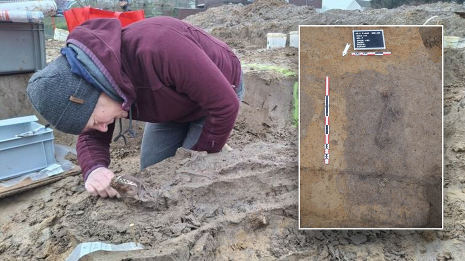
Archaeologists have recently unearthed the remarkably well-preserved remains of a dog from ancient Rome, shedding light on the widespread practice of ritual sacrifice in antiquity.
read more


