- by foxnews
- 08 Apr 2025
Storm Gabrielle: thousands without power on New Zealand’s North Island
Storm Gabrielle: thousands without power on New Zealand’s North Island
- by theguardian
- 13 Feb 2023
- in news

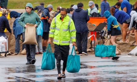
Evacuations were under way and thousands of people were without power as Storm Gabrielle made landfall on New Zealand's North Island, where the largest city is still recovering from record rain last month.
As the former tropical cyclone barrelled towards New Zealand, the MetService issued a series of red weather warnings for intense rain and gale-force winds, including for Auckland, the largest city, which was hit by flooding a fortnight ago.
The city's 1.7 million residents were asked to be vigilant and prepare for the worst. The city could see up to 200mm of rain on Monday, with the Coromandel area to the east in line for 400mm, the MetService said.
"We are looking down the barrel of a very severe and potentially devastating weather event," said Rachel Kelleher, the deputy controller of Auckland Emergency Management.
Many schools and all local council services were closed on Monday. Auckland airport was open but most of the day's domestic and international flights were cancelled.
The city's harbour bridge was closed owing to high winds and train services were suspended until Monday afternoon. Commuters were warned of bus cancellations and urged to stay home if possible.
Late on Sunday night, the storm made landfall in Northland, at the top of the North Island, just above Auckland, where nearly 140mm of rain fell in an hour and severe winds sent trees and power lines tumbling. About 22,500 households were without power overnight.
Rain and wind warnings are in place throughout the North Island for Monday when the worst deluge is expected, but a storm surge could coincide with a high tide in the early hours of Tuesday morning, the MetService said.
It said the western tip of the North Island saw wind gusts of up to 140km/h on Sunday morning, and it warned that Gabrielle was bringing a "very high risk of extreme, impactful and unprecedented weather" over many parts of the North Island from Sunday until Tuesday.
"This is not a system to ignore, the worst is yet to come," the agency said on Twitter.
In a briefing on Sunday, the city's mayor, Wayne Brown, said: "Cyclone Gabrielle is on our doorstep and it will be a challenging time for all of us, but we are well prepared and are taking it seriously. Aucklanders are strong and resilient and we will get through this."
Kelleher said the severe winds and rain would come on top of already sodden land, risking structural problems, landslips, falling trees and power line problems. The whole Auckland region was at risk of flooding, Kelleher said.
He said 370 households were still in emergency accommodation as a result of last month's flooding.
The chaos from that deluge was described as the worst "climate event" in New Zealand's history by insurers, who have received tens of thousands of claims in the fortnight since. Four people were killed when waters swept down suburban streets and highways.
High demand for sandbags in the region remains, and as this week's storm approached, people were asked to prepare emergency packs and remove any blockages around drains and gutters to lessen the risk of floods.
The low pressure generated by the system could cause storm surges not seen for 40 years. The MetService said gale-force winds could extend 400km from Gabrielle's centre. The storm was expected to intensify on Monday "as the low centre curves southwards, towards the Great Barrier Island and Coromandel Peninsula", the agency said.
On Saturday night the cyclone passed over Norfolk Island, an Australian territory, downing trees, blocking roads and causing power outages.
Dr Kevin Trenberth, an Auckland-based climate scientist, said hundreds of homes were still damaged from the "extraordinary" downpours at the end of January. "This isn't just these two events. We've had a raft of subtropical low pressure systems that have bombarded New Zealand this year," he said.
Trenberth, a distinguished scholar at the US-based National Center for Atmospheric Research and an honorary academic at the University of Auckland, said ocean temperatures around New Zealand were very warm and this provided fuel for storms and added moisture for rainfall.
"But there's a clearly a global warming signature to this," he said, pointing to the long-term warming of oceans.
- by foxnews
- descember 09, 2016
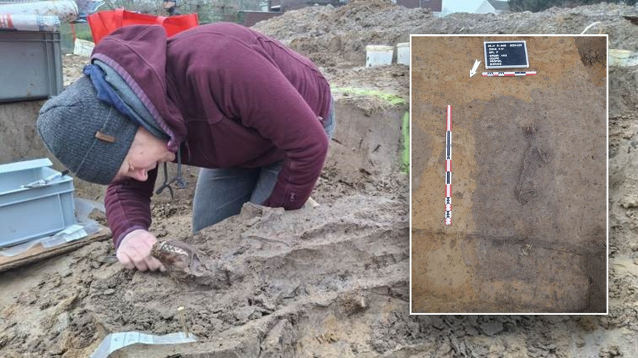
Ancient settlement reveals remains of 1,800-year-old dog, baffling experts: 'Preserved quite well'
Archaeologists have recently unearthed the remarkably well-preserved remains of a dog from ancient Rome, shedding light on the widespread practice of ritual sacrifice in antiquity.
read more


