- by foxnews
- 08 Apr 2025
California governor declares state of emergency over ‘truly brutal’ storm
California governor declares state of emergency over ‘truly brutal’ storm
- by theguardian
- 05 Jan 2023
- in news

Millions of Californians are bracing for the arrival of yet another destructive winter storm on Wednesday, with meteorologists warning the "truly brutal" weather system would bring flooding, strong winds and power outages over the coming days.
California's governor, Gavin Newsom, has declared a state of emergency in response to the extreme weather, authorizing California's national guard to support with the anticipated damage.
Rain and winds from the incoming "bomb cyclone" began lashing the San Francisco Bay Area and the surrounding region on Wednesday, and are expected to intensify throughout the day before sweeping south. Forecasts warned that up to 10in of rain is possible in coastal mountain regions.
The incoming system is threatening to wreak more havoc as the state reels from major storms that have arrived almost back-to-back throughout the end of December and early January. A New Year's Eve downpour gave San Francisco its second wettest day on record, and caused widespread flooding and damage across northern California.
Forecasters anticipate this week's storm will also bring dangerous flooding and the threat of more destruction. In the San Francisco Bay Area, dozens of flights have been cancelled, more than 8,000 sandbags distributed and school districts closed.
Heavy downpours accompanied by winds with gusts of up to 60mph (96 km/h) were expected later on Wednesday and through Thursday and could cause flooding, downed trees and power outages, making driving conditions difficult, the National Weather Service said.
Tink Troy, who lives in south San Francisco, picked up some sandbags from the city's public works department on Tuesday.
"They said (Saturday's storm) was going to be bad, and it was really bad. Now they're saying this one's going to be worse. So I want to make sure I'm prepared and not having to do this when it's pouring rain tomorrow," she said.
Areas that will see lower rainfall could still face disastrous consequences due to the compounding effect of the consecutive set of storms.
"We are expecting fairly widespread flooding impacts," said Richard Bann, a meteorologist with the National Weather Service Storm Prediction Center, noting that heavy snows across the Sierra Nevada range and strong winds could also pose problems for travel and safety. "It is really a multi-hazard event that will last perhaps the better part of two days."
The NWS issued a warning for the risk of excessive rainfall impacting roughly 5 million people across the northern and central California, as agency meteorologists cautioned all who lay in the path of the "truly brutal system" to be prepared.
The impacts could include, "widespread flooding, roads washing out, hillsides collapsing, trees down (potentially full groves), widespread power outages, immediate disruption to commerce, and the worst of all, likely loss of human life", according to a NWS Bay Area's meteorologist, who wrote in a discussion on Monday that "this will likely be one of the most impactful systems on a widespread scale that [they had] seen in a long while".
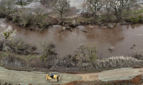
The storm comes on the heels of a wet New Year's weekend. The historic storm broke levees in Sacramento county, submerging thousands of acres and stranding dozens of drivers who were caught in the deluge. Evacuations were ordered for two affected communities and the Cosumnes River reportedly reached its highest level in history.
San Francisco saw widespread flooding after more than 5in of rain hit the city. To the south, two separate sinkholes swallowed cars. By Tuesday morning, roughly 23,000 people were still without power across the state as officials raced to get impacted systems back up and running during a day of dry reprieve.
Officials confirmed on Sunday that one person was discovered dead in a submerged car in Sacramento county. Another, to the south in Santa Cruz, was killed by a fallen tree. The NWS cautioned that, with conditions expected to escalate through the week, more life-threatening dangers loom.
While destructive, the storms have also been welcome news for the drought-stricken state. The snowpack covering California's mountains is off to one of its best starts in 40 years, officials announced Tuesday, raising hopes for the spring when melting snow will help recharge parched reservoirs.
But experts caution it won't be enough to combat long-term dryness, as bursts of strong precipitation are far less helpful than lighter rains over longer periods.
"The significant Sierra snowpack is good news but unfortunately these same storms are bringing flooding to parts of California," the director of the department of water resources, Karla Nemeth, said in a written statement issued with an update on the latest snow survey, which found levels were 177% of average before the big incoming storm. "This is a prime example of the threat of extreme flooding during a prolonged drought as California experiences more swings between wet and dry periods brought on by our changing climate."
Last year showed a similar pattern, with a promising start that led into a long stretch of dry days. Weather whiplash, when strong rains delude parched systems, does less to aid in recovery, especially when storms are severe and destructive.
"We don't want to get all the rainfall to eliminate the drought all at once," said the NWS' Bann. "The fact we have multiple days of this and heavy snow in the mountains will help alleviate some of these concerns - but we have a long way to go."
- by foxnews
- descember 09, 2016
Ancient settlement reveals remains of 1,800-year-old dog, baffling experts: 'Preserved quite well'
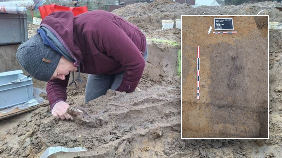
Archaeologists have recently unearthed the remarkably well-preserved remains of a dog from ancient Rome, shedding light on the widespread practice of ritual sacrifice in antiquity.
read more


